Quad Cities
Site Information
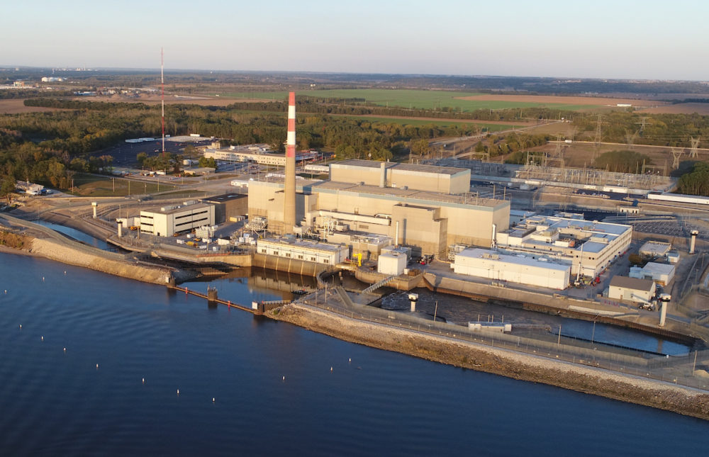
Quad Cities Generating Station has two BWR units, located on the Mississippi River in northwestern Illinois, 30 miles east of Moline, IL and Davenport, IA and 153 miles west of Chicago.
The site is co-owned by Exelon and Mid-American Energy and operated by Exelon. The units were put into service in 1973 and generate 1,880 MW.
Key Contact Information
Westinghouse Site Manager: Marta Overstreet
Cell (815)-830-2029; marta.overstreet@westinghouse.com
Recruiter:
800-225-0385
Reporting Information
GPS Address
22710 206th Ave N, Cordova, IL 61242
Directions/Link to Google Maps
Directions from Quad Cities International Airport
- From airport take I-74 North approximately 1.5 miles and merge right onto I-5 East (John Deere Road).
- Take I-80 West (toward Des Moines) for 2.85 miles and exit onto IL Rt. 84.
- At the stop sign turn right onto Rt. 84 North.
- Go 12 miles until to come to 206th Avenue North. (There will be a drag strip on your right side about ½ mile before the road.)
- Turn left onto 206th Avenue North.
- The plant will be on the left about .31 miles down the road and the Professional Learning Center will be on the right.
Directions from Chicago, IL
- Take I-88 west toward Aurora to mile marker 20 – Erie (approx. 130 miles).
- Turn right onto Erie-Albany Blacktop. This will take you into Albany.
- Turn left onto Route 84 and head South along the river.
- After about 5 miles, turn right onto 206th Avenue North.
- The plant will be on the left about .31 miles down the road and the Professional Learning Center will be on the right.
Nearest Airports
Quad City International (MLI) 32 miles
Preferred Places to Stay
There are no posts here yet